@superkret No one was suggesting that.
markstos
joined 2 years ago
@pleaseclap @DemonHusky @bloomington_in Yes. Many routing services, including Google Maps, use OpenStreetMap data to some degree. The more accurate the data is, in general the better the algorithms can work.
If you know of times where you think you haven’t been given the best bike directions, the issue might be solved by updating something in OpenStreetMap. Which like Wikipedia, anyone can edit and it’s not to hard to get started.
@benfulton @bloomington_in The algorithms don’t know about the debris in the bike lane nor have I heard of carbon monoxide being factored in, BUT the Pointz app allows reporting road hazards and road stress/comfort. But they have few users.
Both Strava and Ride With GPS factor in the routes actually take, so there are options for algorithms that look beyond what’s in OSM data.
@pleaseclap @DemonHusky @bloomington_in In context, the rest of the post says that exceptions are published in city code and provides an example link to the table in our code.
I’m suggesting to use real speed limits from city code. Sorry if that wasn’t clear.
@pleaseclap @DemonHusky @bloomington_in Misrepresentating? I found streets where the max_speed value was missing and added the correct values based on city code.
@pleaseclap @DemonHusky @bloomington_in I’ve looked at the code. My servers have bike routing coverage for most of the US and EU with the OpenTripPlanner and Valhalla engines. Occasionally we find edge cases that don’t route optimally and look into patches.
Lots of roads don’t have max speeds in OpenStreetMap which they both use, so other signals are essential.
@pleaseclap @DemonHusky @bloomington_in That’s right. Many signals are involved. Some factor in cyclist aversion to hills for example.
@pleaseclap @DemonHusky @bloomington_in In the absence of a speed limit signal, the algorithms look for other signals, like the type of road. Cars are routed to arterials over residential streets even they are a bit longer, while bike routing would prefer residential streets.
The Pointz bike routing app is nice because it puts you in control with more options.
@pleaseclap @DemonHusky @bloomington_in I can’t see how any routes will become more direct for anyone, because no new more direct paths are being added.
Tagging a slow speed limit is a signal that cars may want to take a less direct route on streets with faster speed limits, while tagging a high speed limit is a signal for bike routing that cyclists may be less safe and may themselves prefer a less direct but safer route.
9
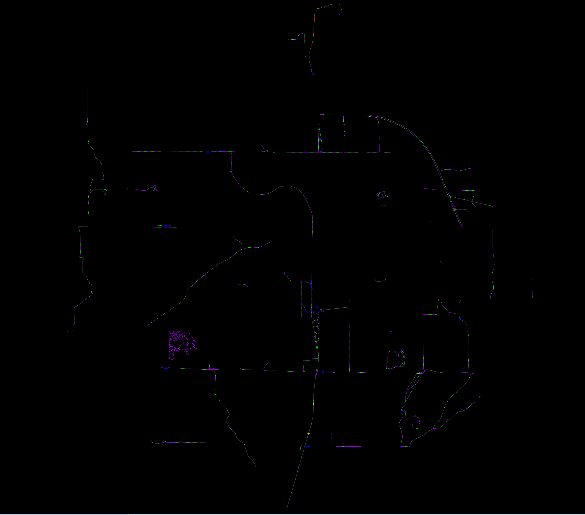
This are the designed, protected routes in Bloomington currently mapped in #OpenStreetMap
(cdn.masto.host)
This are the designed, protected routes in Bloomington currently mapped in #OpenStreetMap
The newer 7-Line is notably absent. And that disconnect bit up north? Those are the trails in Cascades Park.
@benfulton @bloomington_in I’m glad it will create a new connection into the Griffy trail system, but Blue Ridge is high car ownership and car dependency— not many places close by to walk to. I wonder how much it will get used and why it was selected over other locations.
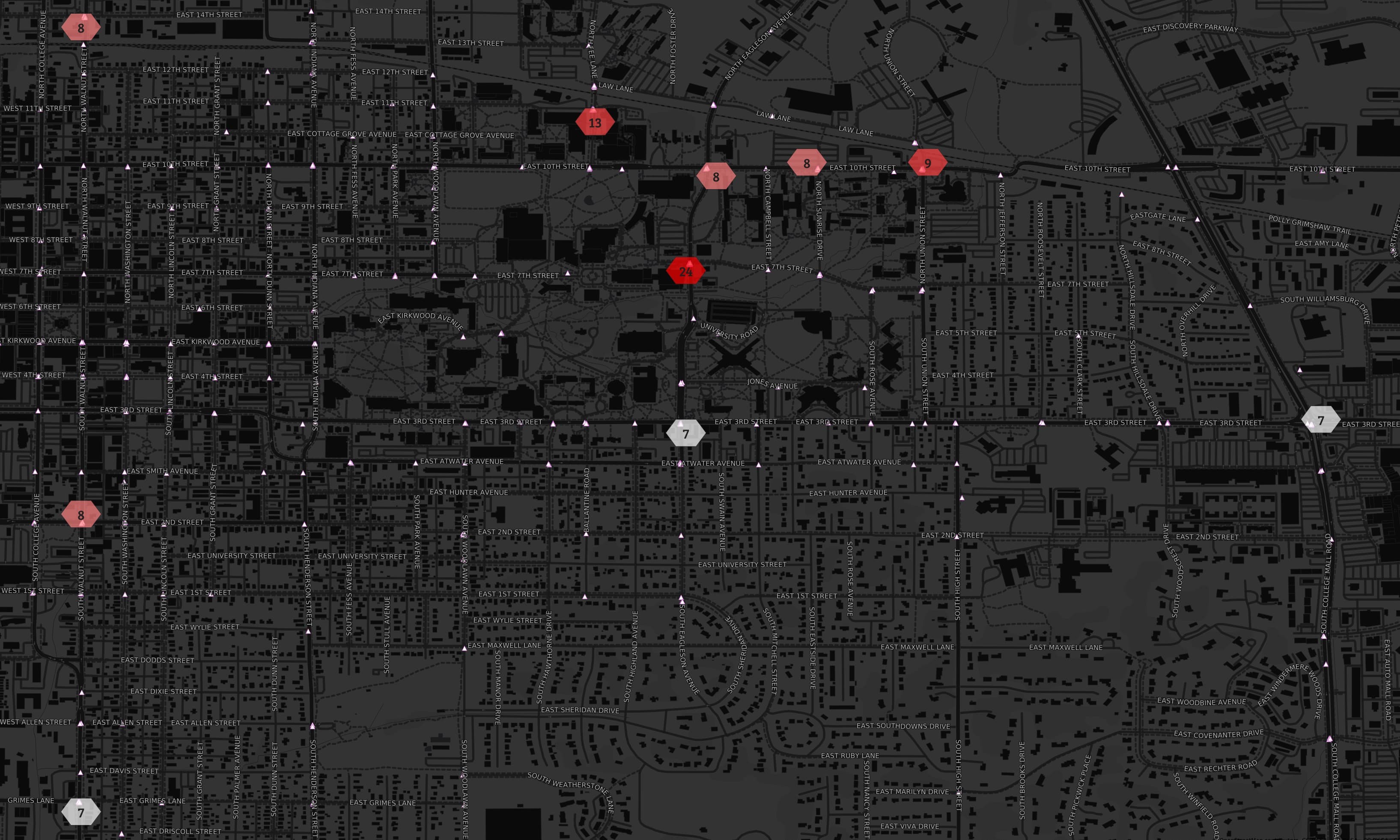
Top 10 Most Dangerous Intersections for Cyclists in Bloomington, Indiana
Visualization of 2003-2022 cyclist-involved crash data. Hexes count number of crashes at those locations while triangles are crash locations.
Big surprise here is 11th and Fee, the #2 spot. 10 of 13 of those have a primary factor of "failure to yield" or "improper turning". My guess is drivers turning onto Fee from garage on 11th, pulling in front of cyclists traveling fast southbound on Fee.
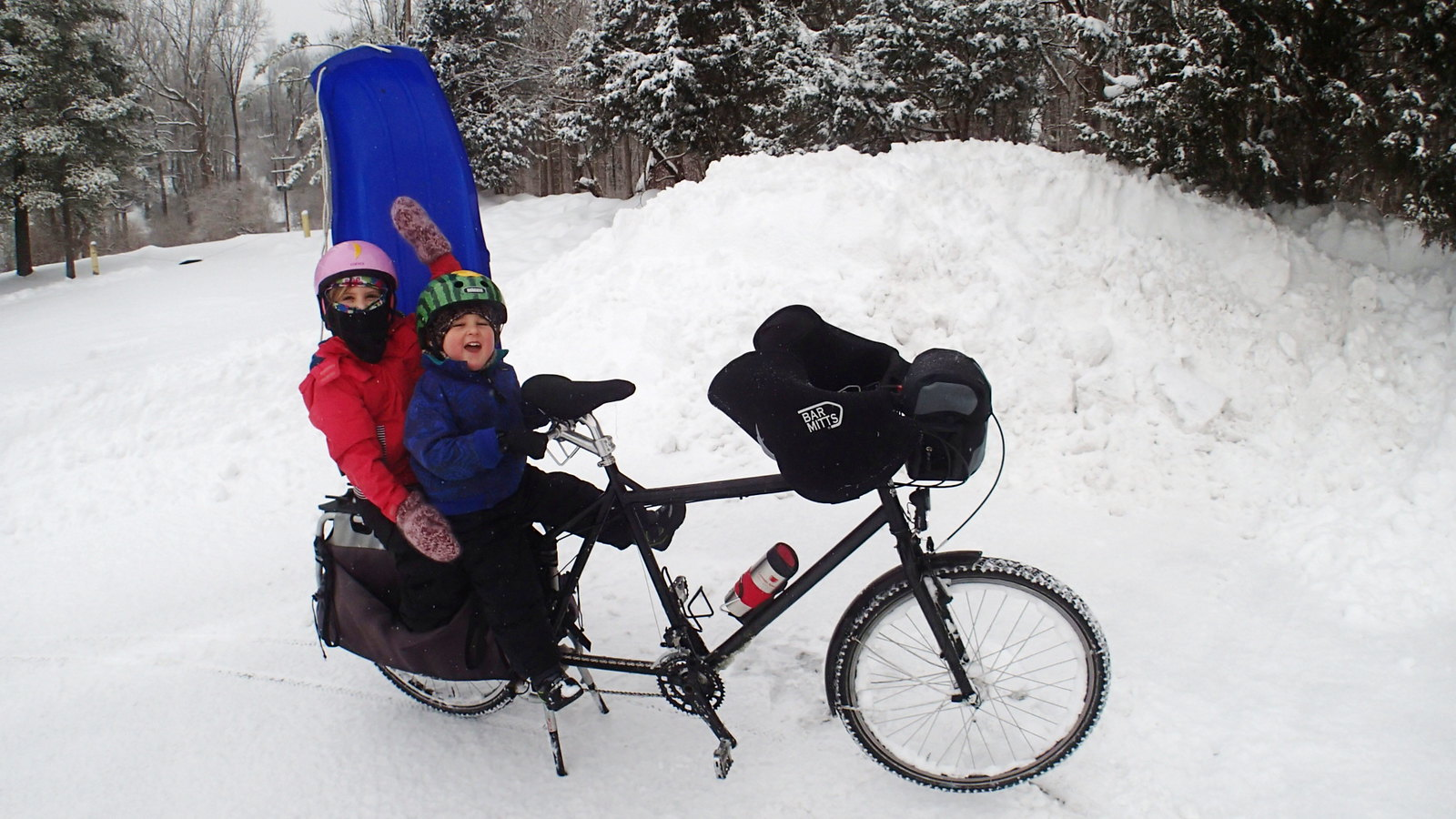
Winter Bike Commuting webinar December 11th, 6pm
I'm on a panel discussion at 6pm tonight about winter bike commuting in Indiana. I'll be focusing my comments on winter bike commuting with kids.
Meanwhile in @bloomington_in
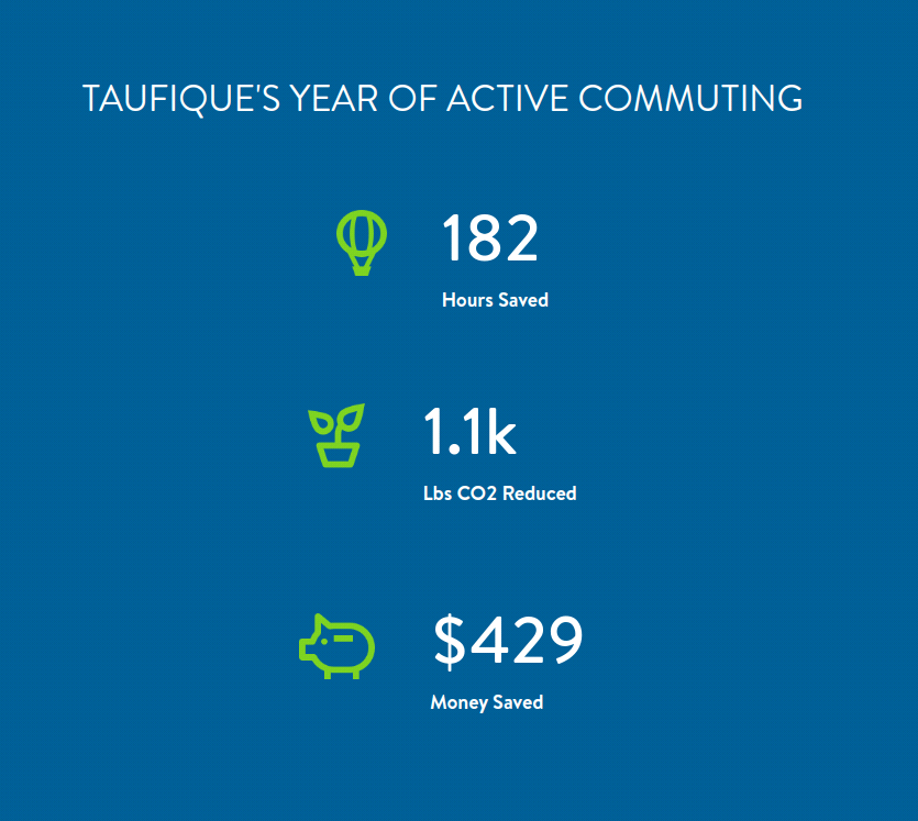
Active commuting saves time*, money and CO2.
Taufique, a busy IU graduate student, calculated these annual savings for his past year of active commuting.
Changes in everyday choices can be a win-win! 🚀
#climate #running #biking #BloomingtonIN @bloomington_in
⏰ * compared to getting the same exercise + also driving.
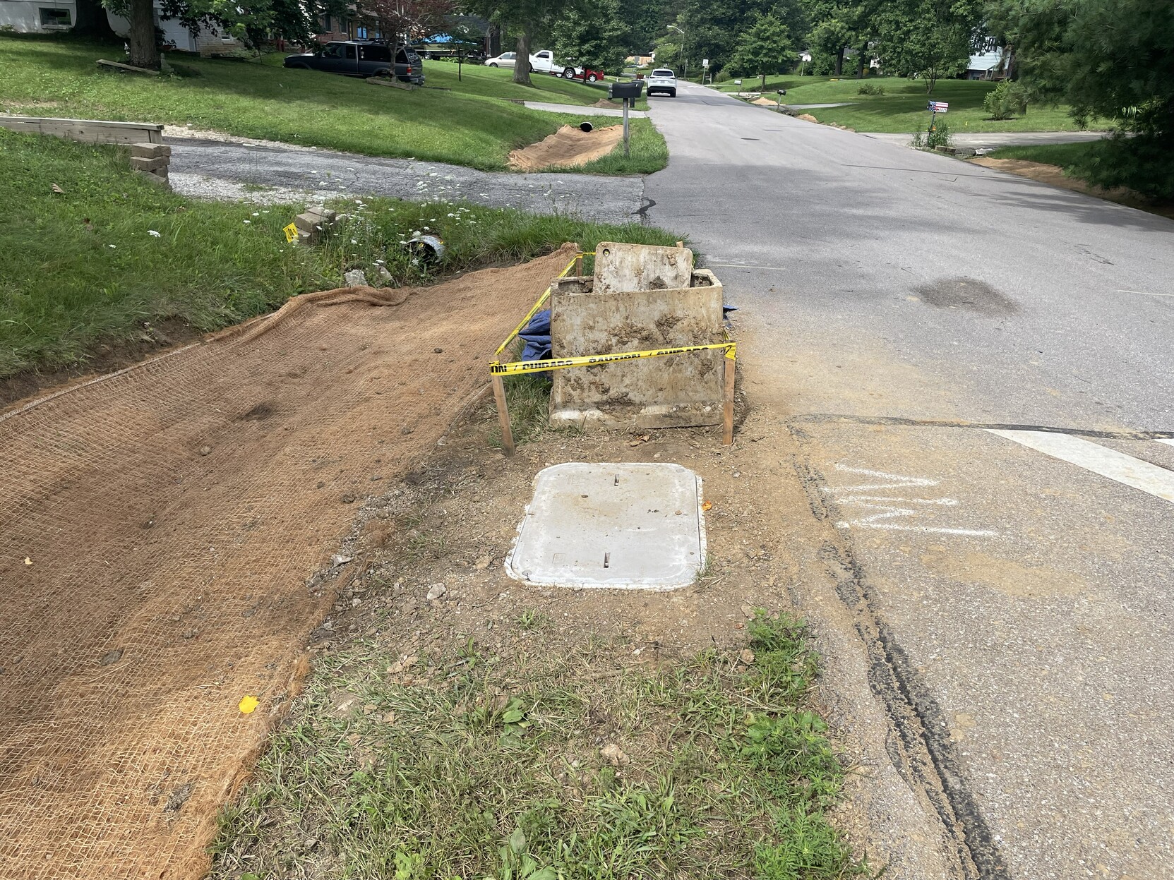
Fiber optic junction boxes installed in drainage ditch getting adjustments.
I think what’s going on in this photo is that a fiber junction box had been installed too low in the ditch, so they replaced it with a new box, slightly higher up. It will still get flooded, but initial research that the fiber optic cables can survive that, if not ideal.
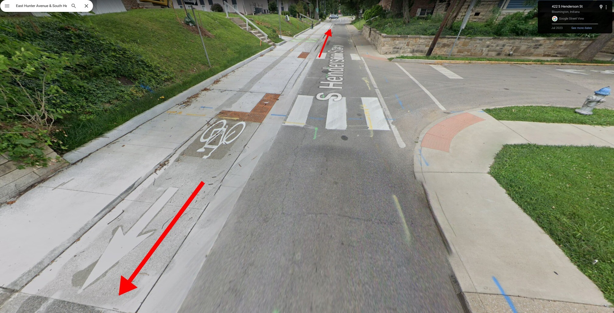
@bloomington_in New bike facility at Hunter and Henderson.
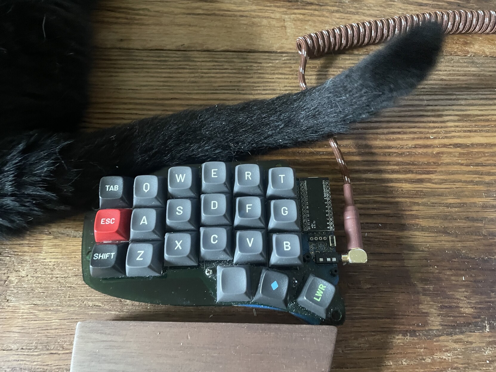
@ergomechkeyboards Num row feels different today but cat tail why.
view more: next ›
@superkret I filled in some missing values based on correct values found in city code.